The 2 worst suffering states to live during nuclear attack revealed in chilling map
With the war in Iran re-igniting fears of WW3 and nuclear war, scientists have deciphered which states would suffer a “nuclear winter” in the event of a nuclear war.
Experts have long warned that parts of the U.S. could be more susceptible to the effects of a nuclear attack due to location.
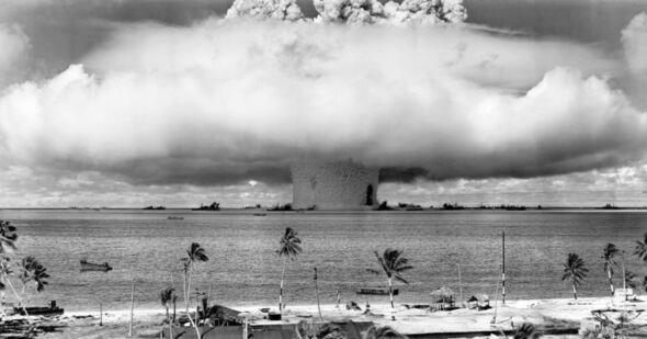
Scientists warn that a large nuclear war could trigger a “nuclear winter,” an event defined as a large cloud of smoke and dust from burning cities rising to the atmosphere and blocking sunlight. It comes after a doomsday study revealed the only two countries that will survive a nuclear WW3.
- Revealed: Barron Trump’s medical exemption from being drafted into US military
- Terrifying nuclear map shows where 75% of people would die if WW3 erupts
Even if a city or state wasn’t directly hit by a nuclear attack, the nuclear winter would prove disastrous for survival, due to lower temperatures and failing crops.
Researchers say that although states such as Michigan and Wisconsin could be in the clear from an initial attack, they’d become virtually uninhabitable during a nuclear winter due to the older climate and reduced sunlight, making it difficult to sustain farming and daily life in the region.
Cities most likely to be under attack
As America’s most densely populated metropolitan area, New York would represent a primary target in any conflict scenario.
Given the dense concentration of residents in the city, a nuclear strike would likely prove devastating, endangering millions of lives.
Other cities that are likely targets are Great Falls, Montana, for its AFB missile silos, Los Angeles for its population density, Washington D.C., due to the federal government, and Honolulu, Hawaii, for its Pacific naval and air operations.
According to the Red Cross, even if a nuclear attack wasn’t in your direct area, you will likely have to shelter for at least 24 hours unless told otherwise by authorities.
In some circumstances, you may need to shelter in place for up to 1 month.
States least likely to be under attack
NUKEMAP-a map created to show the catastrophic impacts of nuclear war, shows the US cities most at risk during a nuclear attack, compiled from data provided by the Federal Emergency Management Agency (FEMA) .
According to the map, Western Texas, most of Nevada, Michigan, and Wisconsin would be “notably in the clear,” reports Mira Safety, which analyzed the data. They added, “With that said, the latter two would likely become uninhabitable in the coming nuclear winter.”
It comes after a chilling map revealed the 4 safest US states to survive during a nuclear attack.